Pinnacles Pictorial

N

Notepad

Guest
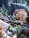
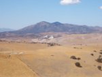
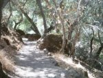
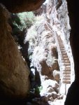
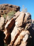
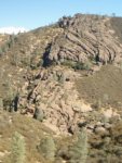
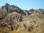
I wanted to share some pictures of the Pinnacles National Monument that I took during some recent visits. In case you don't know what it is, the park is the remnants of a dead volcano split in half by tectonic activity. The split peak (one half in southern Cali, the other half in central California) has been weathered through time, and makes for some nice rock scenery, as well as nutrients for beautiful wilderness.

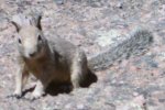
First, a fun visitor who walked right up to me on my walk. This guy was found at the Bear Gulch Reservoir.
 

Attachments

N

Notepad

Guest
And here is a view of the park from the south. The two huge peaks looming over the hill range is half the remnants of the volcano. To the left is South Chalone Peak (3269 ft), and to the right is North Chalone Peak (3304 ft). I plan on going to the top of North Chalone tomorrow morning. By the way, this picture was taken from within the Gabilan Range, from a nice hill vista, to give you an idea of how high those suckers really are.
 

Attachments

N

Notepad

Guest
This is the beginning of the Bear Gulch Trail, which looks inviting enough. Don't let the modest, peaceful looks fool you, though.
 

Attachments

N

Notepad

Guest
Here is a view from within the Bear Gulch Cave, leading up to the Bear Gulch Reservoir. Yes, that peaceful little trail pictured above leads into the caves, which force use of flashlights and the ability to shuffle through rocks like some sort of wild spelunker. The light at the end of the tunnel is this, a one-foot-wide narrow little stairway with rocks hanging into the path, so you have to lean over the rail just to go up while your legs struggle to pass each other on the tiny steps. Yeah...fun...
 

Attachments

N

Notepad

Guest
Of course, to reach the Reservoir or the rest of the trails, one can divert from the latter part of the Bear Gulch Trail, and miss the Bear Gulch Cave altogether (pitty I didn't know this ahead of time). Here is a picture from the bypass trail, known as Moses Springs Trail, of a rock face that is just awesome to look at.
 

Attachments

N

Notepad

Guest
On the Rim Trail, which I thought would lead me through some nice plants according to the guide. Not really, but I did get a good view of some lava formations, such as this one.
 

Attachments

N

Notepad

Guest
This is a view from the High Peaks Trail, which goes nowhere near the Chalone peaks, but goes up the side of those crags you see in the picture. Getting up those crags is a major pain in the butt, and all that awaits you is a tiny outhouse full of nasty insects, and a lone bench in the middle of the scorching sun (no shade within twenty feet of the bench). In case you want to know where this lovely little "rest area" is, look right above the center of the picture, where the large crest on the left and the slight crest on the right tend to meet in a depression. Right there, hidden behind the roundish boulder is the outhouse, and quite a few yards behind it in the full sun is the stupid bench. The map makes it look easy, but the access from both Juniper Canyon Trail and High Peaks Trail is a rough series of steep switchbacks. A total pain in the butt, but it gives a nice view of the Salinas Valley, in all its smog-clogged glory. So much for Steinbeck's vision.
 

Attachments

T

train

Guest
I wish I had pictures from my backpacking trips...

Southern Colorado is also very beautiful...

thanks for the pics SeFRo...
 
M

Mikeymike

Guest
Good stuff, I never even heard of Pinnacles before (and I was a nature/scenery/Nat. park dork in highschool).
 
Top